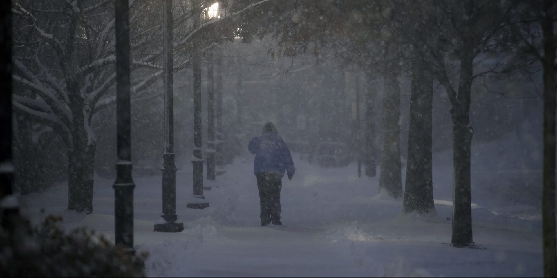
A man walks through the Villanova University campus during a snow storm, Wednesday, Dec. 16, 2020, in Villanova, Pa.
Matt Slocum / AP Photo
A man walks through the Villanova University campus during a snow storm, Wednesday, Dec. 16, 2020, in Villanova, Pa.
Matt Slocum / AP Photo
Matt Slocum / AP Photo
A man walks through the Villanova University campus during a snow storm, Wednesday, Dec. 16, 2020, in Villanova, Pa.
(Harrisburg) — As the the region enters the second day of amulti-day storm, the National Weather Service said the storm is far from over.
Meteorologist John Banghoff said central Pennsylvania is still on pace to have winter weather for the next 24 to 36 hours.
Sunday night saw snow slowly accumulate for a few hours in the Harrisburg region and the southeastern part of the state.
As of 5 p.m., 2 inches of snow was recorded at Harrisburg International Airport, Banghoff said. A few inches of snow have fallen in the southern tier, while north of Harrisburg has seen only an inch or two thus-far.
Those numbers could increase overnight, but Banghoff said the Harrisburg region could see a pause in accumulation as the storm changes to a wintry mix of sleet and freezing rain between midnight and mid-morning Monday.
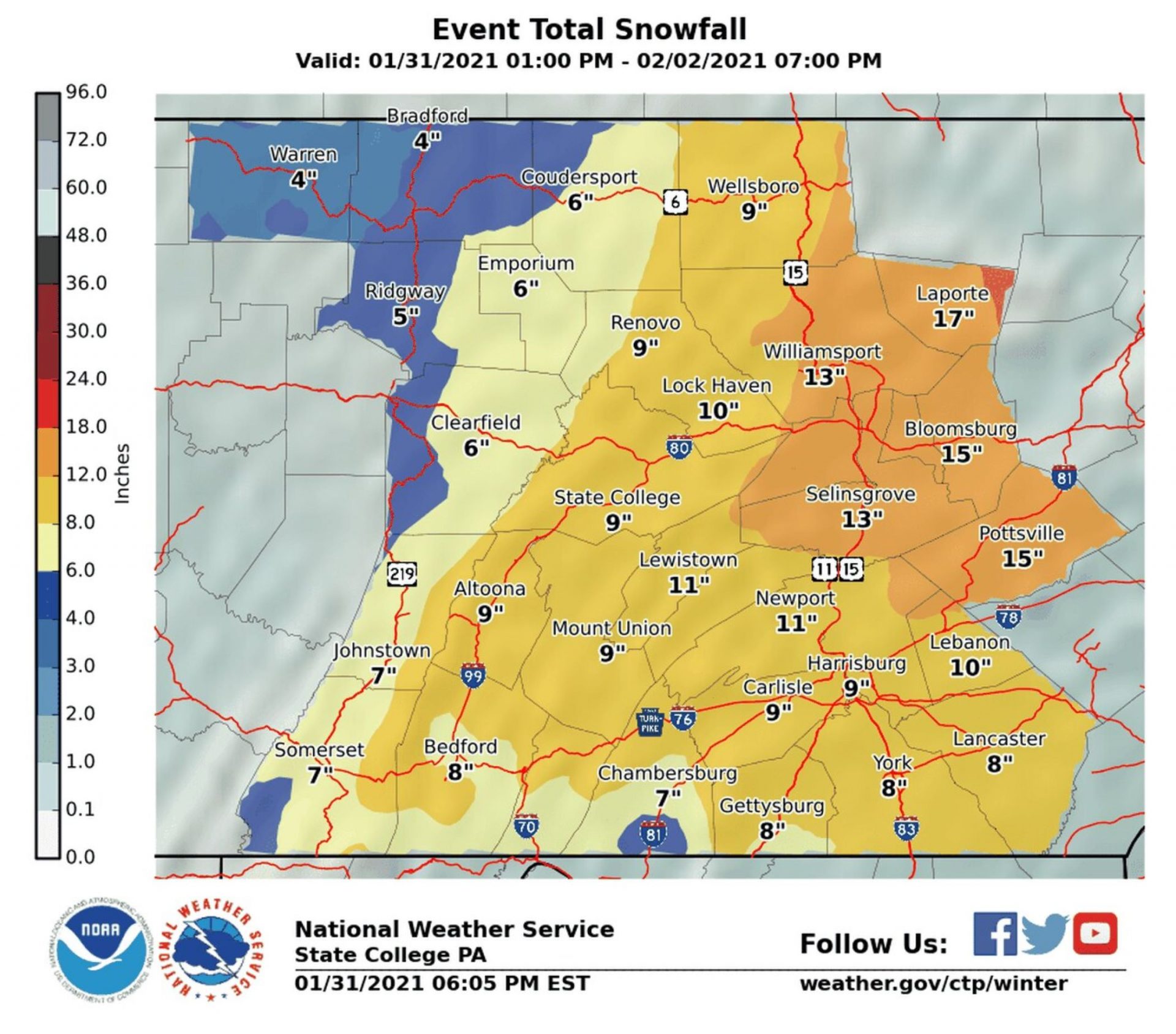
The National Weather Service is predicting more than foot of snow in parts of central Pennsylvania.
Banghoff said as far north as Lebanon and Harrisburg could see a wintry mix, down to York, Gettysburg and Chambersburg.
Then, during the day, the storm will change back to snow throughout the region.
The big thing the NWS is monitoring is a “heavy snow band” that could set up Monday going into Tuesday.
“There’s quite a bit of uncertainty,” Banghoff said. The heavy snow band could bring snow falling at a rate of more than an inch an hour.
Banghoff said the total snowfall from Sunday to the end of the storm could be in excess of a foot of snow. As of Sunday night, he said it looks like that band of snow may hit a little farther northeast, like the Allentown region, but it isn’t certain.
Sunday’s storm came from the west, first hitting areas like Chicago, Ohio and western Pennsylvania, Banghoff said. Sunday night into Monday will create a “transfer of energy” from that storm to another one coming off the Atlantic coast.
The final snow totals will be determined by how far inland the storm goes, and how much energy it gains along the way.
For anyone questioning how serious the storm will be based on Sunday’s snow totals, Banghoff said the meat of the storm is coming mid-day Monday into early Tuesday.
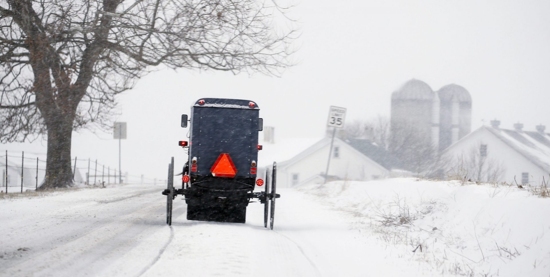
Jim Gerberich / AP Photo
An Amish buggy traverses the backroads of Lancaster County, Pa., Sunday, Jan. 31, 2021.
Banghoff said forecasters have seen this storm coming, which has left time for municipalities and families to prepare.
“Just do not let your guard down because the forecast is still pretty well in hand,” Banghoff said. The heaviest snowfall is coming, and “that’s going to be the worst of the storm.”
Winds were not an issue Sunday, but Banghoff warned that along with the heavy, wet snow, a strong-easterly wind with northerly gusts of 25-35 mph could come Monday into Tuesday.
Between the wind and the weight of the snow, Banghoff said there could be some power outages and other related impacts in the coming days.
Harrisburg has not declared a snow emergency as of 6:30 p.m. but has instituted some snow protocols, including opening up the Locust Street Garage for free parking until the storm is over.
PennDOT and PA Turnpike implement additional vehicle restrictions in response to winter storm
In response to winter weather conditions through much of the state, the Pennsylvania Department of Transportation (PennDOT) and the Pennsylvania Turnpike Commission (PTC) are implementing additional restrictions on trucks and other vehicles on certain roadways around the state, which will begin at 9:00 AM and remain in place until conditions warrant their removal. Motorists are urged to avoid travel if possible.
Effective at 9:00 AM, vehicle restrictions are anticipated on the following roadways at Tier 3 of the commonwealth’s weather event vehicle restriction plan:
On roadways with Tier 3 restrictions in place, no commercial vehicles are permitted EXCEPT loaded single trailers with chains or approved Alternate Traction Devices. Additionally, all school buses, commercial buses, motor coaches, motorcycles, RVs/motorhomes and passenger vehicles (cars, SUVs, pickup trucks, etc.) towing trailers are not permitted on affected roadways while restrictions are in place.
Effective at 9:00 AM, vehicle restrictions are anticipated on the following roadways at Tier 4 of the commonwealth’s weather event vehicle restriction plan:
On roadways with Tier 4 restrictions in place, no commercial vehicles are permitted. Additionally, all school buses, commercial buses, motor coaches, motorcycles, RVs/motorhomes and passenger vehicles (cars, SUVs, pickup trucks, etc.) towing trailers are not permitted on affected roadways while restrictions are in place.
Tier 1 restrictions remain in effect on the following roadways:
Under Tier 1 restrictions, the following vehicles are not permitted on affected roadways:
Additional speed and vehicle restrictions on these and other interstates could be added depending on changing conditions.
Restrictions will be communicated via variable message boards, the 511PA traveler information website at www.511pa.com and smartphone apps. Motorists can also sign up for alerts on www.511pa.com by clicking on “Personal Alerts” in the left-hand menu.
PennDOT urges motorists to avoid travel during the storm if possible. But if travel is necessary, use caution, reduce speeds and be aware of changing weather conditions. High winds and freezing temperatures are expected during this event, so motorists should be aware of blowing and drifting snow, which can cause icy areas on roadways, including overpasses and bridges. With freezing temperatures, roads that look wet may actually be icy, and extra caution is needed when approaching bridges and highway ramps where ice can form without warning.
To help make decisions regarding winter travel, motorists are encouraged to “Know Before You Go” by checking conditions on more than 40,000 roadway miles, including color-coded winter conditions on 2,900 miles, by visiting www.511PA.com. 511PA, which is free and available 24 hours a day, provides traffic delay warnings, weather forecasts, traffic speed information and access to more than 1,000 traffic cameras. Users can also see plow truck statuses and travel alerts along a specific route using the “Check My Route” tool.
511PA is also available through a smartphone application for iPhone and Android devices, by calling 5-1-1, or by following regional Twitter alerts accessible on the 511PA website.
For more information on safe winter travel, an emergency kit checklist and information on PennDOT’s winter operations including a video, visit www.PennDOT.gov/winter. Additional winter driving and other highway safety information is available at www.PennDOT.gov/safety.
Follow the conversation by using #PAWinter on Twitter at www.twitter.com/PennDOTNewsand visit the department on Facebook at www.facebook.com/PennsylvaniaDepartmentofTransportation.
Sometimes, your mornings are just too busy to catch the news beyond a headline or two. Don’t worry. The Morning Agenda has got your back. Each weekday morning, host Tim Lambert will keep you informed, amused, enlightened and up-to-date on what’s happening in central Pennsylvania and the rest of this great commonwealth.